
If you ask Dynamo to show you the coordinates of the Survey Point you could be surprised by the result.
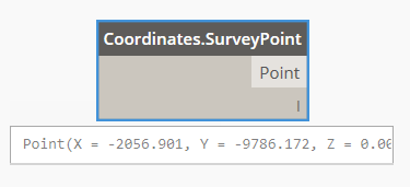
That's because Dynamo uses the Project Base Point as Origin with the Orientation set to Project North. Therefore these are the Survey Point Coordinates calculated from the Project Base Point.
If you place a column at (0,0,0) it will match the position of the Project Base Point:

For a generic Point in space we can have 4 different situations.
1. The Point Coordinates are taken from the Project Base Point and the True North matches the Project North.


2. The Point Coordinates are taken from the Survey Point and the True North matches the Project North.

The Coordinate System Origin in Dynamo is coincident with the Project Base Point.
We need to recalculate the Point Coordinates from the Project Base Point.
We can subtract the Project Base Point Coordinates (calculated from the Survey Point!) from the Point Coordinates (8557,17586,0).


Things get more complicated if your Project North is not aligned with the True North...

If you set your orientation to True North, the Coordinate System rotates and the Survey Point x and y coordinates change (in red) but Dynamo does not change its Coordinate System. Therefore the Survey Point Coordinates measured in Dynamo will remain the same:

3. The Point Coordinates are taken form the Project Base Point and the Project North is not aligned with the True North.
In this case we have 2 different Coordinate Systems both with the origin on the Project Base Point.
We can use Excel to transform the coordinates from one system to the other.

Or we can do it in Dynamo in few steps.

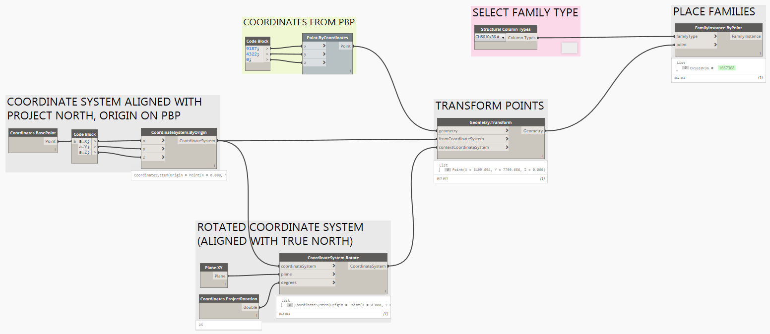
4. The Point Coordinates are taken form the Survey Base Point and the Project North is not aligned with the True North (most common scenario).
In this case we have 2 different Coordinate Systems: one aligned with the Project North and centred on the Project Base Point, the other one aligned with the True North and centred on the Survey Point. The same equations as before can be used but we need to take into account the different position of the Coordinate System origins.

We can use Excel to transform the coordinates from one system to the other.
Or we can do it in Dynamo in few steps.
4. The Point Coordinates are taken form the Survey Base Point and the Project North is not aligned with the True North (most common scenario).
Or in Dynamo:

To summarise, we have two coordinate systems: one centred on the Project Based Point oriented to the Project North and the other centred on the Survey Point and oriented to the True North.


Download the files here
To summarise, we have two coordinate systems: one centred on the Project Based Point oriented to the Project North and the other centred on the Survey Point and oriented to the True North.
Download the files here
Commenti